vrijdag 30 januari 2015

Cazaza

CAZAZA


This place near Sidi Messaoud on the west-flank of the peninsula Tres Forcas was indicated by César Luis de Montalban on his map from 1932 as a finding place of Phoenician/Punic findings. There was no further specification available. Also R.Fernandez de Castro mentions the place in 1943 in the publication: “Historia y exploracion de las ruinas de Cazaza, villa del antiguo reino de Fez, emplazada en la costa occidental de la Peninsula de Tres Forcas. » Enrique Gozalbes Cravioto presents with his study: “Algunes Avatares de la Arqueologia colonial en el norte de Marruecos (1939-1942) ». A study on the organisation of archaeology in the North of Morroco between the years 1939-42 as well as some incidences in the development of the same one. Also in the work the archaeological discoveries that are analyzed at the same time they became in Tanger. Still there are no specific references to Phoenician or Punic findings. Finally we find the publication of again Enrique Gozalbes Cravioto : “Notas sobre Cazaza, Puerto de Fez y Fortaleza Espanola (1506-1533)”  Cazaza was a medieval city that, during some thirty years in the XVI century, was occupied by the Spaniards. In this article he studied and interpreted the archaeological vestiges and add new data for their knowledge drawn from documentation not used until that time. Gozalbes speaks now only of a medieval city. After 1944 it seems that there were no further excavations.
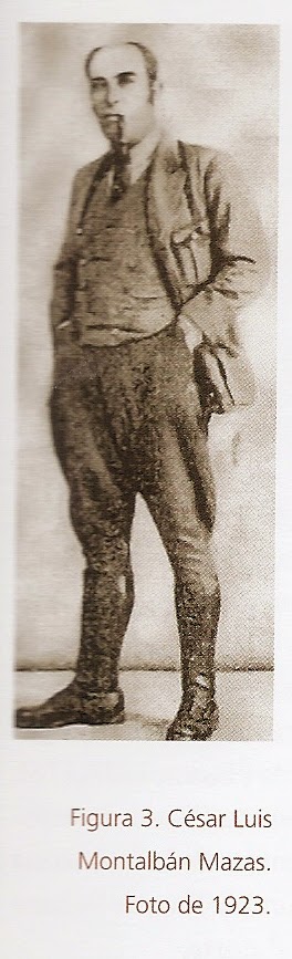
I have a problem now, because there is the allegation of Montalban that there were Phoenician and Punic findings done, but later there comes no confirmation whatsoever! Luckily Enrique Gozalbes Cravioto (must be very old by now!) was willing to give an explanation, which I received yesterday:

“Hello, good afternoon, Mr. Henk van Diessen. I hope to answer as precisely as possible to your question. CL Montalbán explored the ruins of Cazaza in 1929. In its report noted the appearance of "Punic and Roman pottery" in a certain amount. What Montalbán understood by Punic pottery? The distinction between the Punic and Roman layers was undoubtedly evident to him because he had dug in deep layers of Lixus, but I'm not entirely sure.
Yes it is entirely true that in later works, from the forties, the appearance of Campanian pottery and Roman sigillata reflected and Spanish coins minted at least in the first century BC. On my visit there many years ago I observed the presence of fragments most likely common Roman pottery, as well as three fragments of Roman sigillata. Thus, the presence of occupation is undeniable since the first century BC. A  former presence is plausible, but nothing is certain. Montalbán did not invent data, but could have made mistakes, and therefore we should be cautious about their findings.
I hope this answer will be useful.
Yours sincerely”

I hope I translated the Spanish from Gozalbes to decent English, but his view is clear. There was a Roman settlement in the 1st century BC at Cazaza. The findings of Montalban must be treated cautious. So we are not sure of a Phoenician or Punic settlement at Cazaza. However, after 1944 there was no thorough excavation done. Still much work to do here.


The distance between Melilla and the next great harbour Al-Hoceima is c.100 km. That is normally too long to do it in one day (and night). Therefore a port of call in between somewhere must have been there. Cazaza, Aazanèn or Sidi-Amar-ou-Moussa are the most probable options.


dinsdag 27 januari 2015

Rusaddir

RUSADDIR


Melilla lies on the south-eastern flank of the Tres Forcas Puninsula (Cap des Trois Fourches), where Africa’s northern shores are washed by the waters of the Mediterranean. Thanks to its privileged position. It is and always was the gateway to Africa. Melilla was founded by the Phoenicians under the name of Rusaddir and was subsequently occupied in turn by Carthaginians and Romans. The Phoenicians were present in the 8th-6th century BC. The town had different names: Herma, Akros, Metagonium and Rusaddir.
The Phoenicians and Punics left some remnants behind: In the necropolis Cerro de San Lorenzo there were graves in 1904 with amphorae and jars from the 3rd century BC. All this is now vanished. Other excavations were undertaken on the Plaza de armas and in Melilla La Vieja. Furthermore there a Neo-Punic inscription on a coin with the letters: Rš’dr. Another inscription (N1 Jongeling) contains the name of a man: Bodaštart = in/from/through the hands of Aštart. The coins of Rusaddir are studied in: La moneda de Rusaddir, una hipotesis de trabajo, Pilar F.Fernandez Uriel Gerion 2004). It is a study of the monetary emission from the coins in which is analysed the diffusion and also the possible reading in the light of all the historic documentation.
- a coin found in Cherchel (1st century BC) with the Hebrew letters RSADR = R(u)SAD(i)R.
- 3 other coins from the Casa del Gobernador. One coin comes out of Tamuda with the Punic letters: RSA. These coins measure ca.24 mm and have a weight of 11,3-9,6 gram.
Finally P.F.Fernandez Uriel tries to connect these coins with Aštart, Baal-Melqart and Aštart-Tinnit. Even a relation with the town Arados comes into the picture.
Many classical writers are familiar with the name!
Pomponius Mela (I 29) mentions the town as “the little town Rusigada…”. Plinius (NH V 18) has the name Rhysaddir and Ptolemeus (IV 1,3/4,1) comes with the Greek names:
Pουσσαδιριον, Pουσάειϱον, Pμσάδειϱον = R(o)usadeiron. Ps.Skylax describes the town as : Akros, the city and the gulf …”. Strabo (XVII 3,16) pays more attention to the accompanying cape: Akra Megàle = Aκρα Ϻεγάλη. This is the promuntorium Rusaddi=peninsula Guelaïa = Cap Tres Forcas. The name means: great cape or mighty cape.
Under emperor Caligula Rusaddir comes under direct control of the Romans (41 AD). It was in Roman times when Rusaddir came to be treated as a part of Iberia for administrative purposes. De It.Ant (p.4.11) calls it now Colonia Rusaddi.
In 484 AD the town is mentioned during a bishops-council in Carthage.
The invasion of Africa by the Vandals saw the city razed to the ground.

Literature:
- M.Taradell, Marruecos punico, Tétuan 1960, p.63-73.
- M.Taradell, La necropolis punico-mauritana del Cerro de San Lorenzo en Melilla in: I Congresso archeologico del Marruecos espanol, Tétuan 1953, p.253-266.
- J Février, Inscriptions puniques et néopuniques in : Inscriptions antiques du Maroc I, Paris 1966, p.81-132.
- E.Gozalbes-Cravioto, Novedades de numismatica de la Mauretania Occidental, Ant.Afr. 34 (1998) p.21-30.

- L.Ruiz Cabrero, Dos grafitti punicos de Melilla in : Studi di Egittologia e Antichita Puniche 17 (1998) p.55-65 (2nd-1st cent.BC).

zondag 25 januari 2015

Montalban

HOMAGE to César Luis de Montalban.


This Spanish archaeologist was a very special figure. He conducted between 1920 and 1940 many excavations in the former Spanish Morocco. In addition, he collected many articles and made many notes, but he hardly published his excavation results. He presented his oral conclusions and findings on its employees. Montalban does have compiled a wonderful overview in 1933, in which countless places with Neolithic, Phoenician, Carthaginian, Roman, Gothic and Arabic finds are displayed. However, a thorough accountability is lacking.
Title: Central Monumento the Historicos y Artisticas. Mapa Archeologico de la zona del protectorado de Espana and Marruecos con las rutas Terrestres y Maritimo y los Yacimientos paleoliticos, neoliticos, Fenicios, Cartagineses y Romano por César Luis de Montalban (1933).


From east to west Montalban announces the following locations with a Phoenician or Punic background: Melilla (Rysaddir) Cazaza, Alumecas / Axdir / Einzo, Paritiena / Penon de Velez, Cabo Tris, Mestasa, Punta Pescadores (Cobvcla) Taasa, Maaden, Bohamel (Taenia Longa), Ras Targa, Oad Lau (Lavd Plvmen), Tetuan (Tamvda), Ceuta (Ad Abilem) Alcazarseguer (Valone), Tangier (Tingis), Zel Had (Ad Mercuri), Arcila (Zilis), Lalla Yilalia (Tabernae), Larache (Lixus), Alcazarouivir (oppidvm Novvm).

In the interior, he also gives some places at El Barch, Ravoa, Dar Aqaba and Amar u Said. Many of his findings were later confirmed by his immediate successors, such as: MTaradell, R.Thouvenot, P.Quintero, M.Gomez Moreno, E. Gozalbes Gravioto. Montalban has reminded them of the way they had to go. However, there are still places where Montalban was present, but his successors not yet!


ncfps

vrijdag 23 januari 2015

DE WILDE KUST

LITUS IMPORTUOSUM

Sallustius (1st cent.BC) called this coast of Algeria from Rachgoun to the mouth of the Oued Moulouya in this way (inhospitable/coast with no harbour).  However, Teissier says he found a Phoenician village in Sidi Samegram (Rev.Afr.1927, p.258). I can’t find this place on any chart now. G.Vuillemot searched along this coast in the places at Honein, Isle of Mokreum, Nemours and Port Say, but he found hardly anything, that looked like Phoenician or Punic. Perhaps there is an exception in Honein, but even that is not certain. These places have now other names: Honaïne (Honein) and Ghazaouet (Nemours). In antiquity the Oued Moulouya was called: MVLVCHA or MALVA FLVMEN. Honein got the Roman name: CYPSARIA PORTUS. Nemours was called AD FRATRES.
Now the coast stretches out over a distance of c.80 Km. It is therefore plausible that there was at least one port of call. Halfway Honein or Nemours would be the most acceptable locations for it.
Close to the mouth of the Oued Moulouya we find the Chafarinas islands. Those are difficult to enter for ships. They must have been used only in case of emergency. We arrived at last in Morocco now. Here ends the eminent work of Vuillemot and starts that of Montalban.

Honein: 
 Nemours:
ncfps

woensdag 21 januari 2015

Camerata

Camerata.
=======

On the way to the west after Mersa Bou Zedjar we encounter first the mouth of the Wadi Salado near the Plage Terga. It has good anchorage possibilities, but no Phoenician or Punic relics were found here. The next Wadi is called Ghazer, 35 km southwest of Cape Figalo. In this place G.Vuillemot found the handle of a Punic amphorae in an erosion slope which seems to indicate that a pre-Roman trade centre existed at this site (Reconnaissance, p.34). Until now no excavation has been done, but there are some ruins at the mouth of the Wadi Ghazer.
The attribution of coins with the Neo-Punic legend k m ’  to Camerata remains uncertain. See: Numismatique de l’ancienne Afrique, L.Müller, Copenhague 1860-1861 (NAA III p.124f, no 214). The Roman borough of Camerata occupied the site of a Moslem citadel erected at the mouth of the Wadi Ghazer. The evidence is meagre, but it is not impossible, that there was on this spot a pre-Roman trade centre.


ncfps

Rachgoun

RACHGOUN


The Phoenicians provided the North-African coast with dozens of strongholds and anchorage places. One of them was called Rašgun or Akra. Nowadays it is named aš-šakur or Argikule.
Ps.Scylax (111) mentions in the 4th century BC: “facing the river (=Sigi), the island of Akra, a large city and a harbour”.  This must be the island of Rašgun, distant 1700 metres from the shore in front of the river Tafna in western part of Algeria. The island rises 64 metres above the sea. The source of Ps.Scylax – the writer assembles information from others – only translates the first element of the toponym, since Rašgun appears as a corrupt form of Ra’š-šigan (Cape of Siga). Originally this was the name of the promontory of the Moorish Tower that protects the mouth of the Tafna river from the northeast. Phoenician-Punic remains contemporaneous of the insular settlement were found there and suggest an early occupation of the site by people living on the island. In the course of time the name of this cape (Akra) was extended to the island. The real Phoenician name of the island could have been ’y-r’š-sgn (=island of the majestic cape). This would be the same as Rusguniae (Cap Matifou in the middle of Algeria). The Phoenicians are using sometimes the same name for different places. The only site on the island that could be regarded as a harbour is a creek the water-plane of which measures 20 by 15 metres that is accessibly by a channel only 1.8 metre large and 0.6 metre deep. This recess on the seashore looks like an ancient Phoenician “cothon”. These small measures are not exceptional. In Motya and Toscanos we see comparable measures for the “cothon”. Only small boats could in this way reach the island. Greater ships must have been anchoring in the mouth of the river Tafna. Excavations in the “Necropolis of the lighthouse” have uncovered both cremation and inhumation burials with early Punic material, witnessing also connections with the Phoenician settlements on the Iberian Peninsula. There were 114 graves uncovered. Memorial stones (with inscriptions) are lacking. Jars with shoulder, funerary urns, dishes with a large rim, datable to the 7th century BC, were found mixed with handmade pottery, abundant in this burial context. On a scarab we find the hieroglyphs nb nfr sw (-shou, son of Râ) from the 7th century BC. The graves also yielded a number of weapons, like spearheads, amulets and silver jewellery from the 7th-6th century BC. Child burials were found as well: the small bodies were placed in natural cavities of the rock, the head always covered with a large stone. This habit has a similarity with some burials in Phoenicia where the diseased got a golden plate on the mouth. Soundings in the southern part of the island uncovered parts of dwellings, coarsely built in roughly broken rubble-stones bonded in mortar. Most walls were 0.50-0.55 metre thick and the preserved height hardly exceeded 0.50 metre. It was not possible to establish the plan of an entire house, but a disposition of rooms in file was observed, as well as the presence of windows and benches in stone. The use of baked bricks was limited for clay had to be brought from the mainland. No sanctuary or tophet was found on the island so far. For the water supply one was dependable on boats coming from the mainland, or the residents used the water from cisterns on the northern edge of the island. Like in the cemetery, the oldest material can be dated from the mid 7th century BC, while nothing seems to postdate the first part of the 5th century BC.  For some unknown reason at first sight, the settlement was then abandoned. Some occupation traces might remain in parts of the island which have not been investigated. When ps.Scylax refers to a large town it seems he got his information from an early 5th century BC source. However, fragments of Punic amphorae from the 5th century BC found on virgin soil, indicate that the use of the river-harbour at Siga on the river Tafna started in the final occupation period of the Rachgoun Island. The situation on the mainland must have felt save enough for the residents of the island in order to move to the river-harbour, which was called Takembrit in this period.


See: G.Vuillemot, Réconnaissances aux échelles puniques d’Oranie, Alger, 1962.

See : E.Lipinski, Itineraria Phoenicia, OLA 127, Studi Phoenicia XVIII, Leuven, 2004.

maandag 19 januari 2015

Mersa Bou Zedjar

MERSA BOU ZEDJAR

This place near Cape Figalo is a strange location full of question remarks. It starts with the Itinerario Antoninus (13,5): 26 miles to the east of Castra Puerum lies the town of Gilva or Gilua. That is about the location of Mersa Bou Zedjar. S.Gsell suggests to G.Vuillemot that he should search in Mersa Bou Zedjar. On a rather hostile coast for seamen this is the only possibility for a port of call, some 11 km west of Mersa Madakh. And indeed G.Vuillemot found some pre-Roman ruins. And more than that: also fragments of Punic and Italic amphorae of Campanian ware and Punic ovoid jars from at least the 3rd century BC. Besides that a Libyan inscription was found on a stele with a ritual scene at 1.5 km distance from the ancient settlement. Strange enough: there are no Roman vestiges. The pre-Roman settlement is located on the foreland of Sidi Moul Baḥar, a rock just to the north of Cape Figalo. In antiquity there was still a marsh around the ancient settlement, but in recent times it is drained now.
There is a lot of deliberation going on about the exact spelling of the name of the place. O.Cuntz thinks that we should read Silua instead of Gilua. That refers to:
Al-Bakri speaks of a town Aslan between Wahran (Oran) and Argikuk (Rashgoun).
On Punic coins we find the name ’sldn (2nd century BC) according to Mazar and Charrier. Lipinski and Krahmalkov are coming with the name ’šlbn (Müller 3.67 coins) and Krahmalkov mentions that with Salviana on page 461.
If the routing Gilva -> Gilua -> Silua -> Aslan > sldn -> šlbn -> Salviana is correct, then we have here a Punic settlement with the name on coins and Punic pottery. But that is all there is. It is not very convincing. On the other side it is the only possible port of call on the rather hostile coast. There is still a question mark: why there could be a Latin name (Salviana) and no Roman vestiges on the place.


vrijdag 16 januari 2015

Les Andalouses


LES ANDALOUSES

It is a complete surprise to find next after the Portus Divini an almost fully equipped Phoenician/Punic/Berber settlement on a spot that is not so favourable at all. Why did the Phoenicians make or took over on this bay between the Cape Falcon and the Cape Lindless this settlement with no significant harbour. It is true: there are some little islands in front of it: Isle Plane and the isles Habibas. They were visited by the Phoenicians, because one has found Campanian pottery here from the 6th century BC. A large settlement however was developed on the coast on both sides of the mouth of the Oued Sidi Hamadi. The reason why maybe the favourable agricultural possibilities, that were already exploited by the indigenous population. The site of Les Andalouses is located at the fertile plain some 30 km to the west of Oran.
It was identified by Ps.Skylax (111) as Mes in the 4th century BC and in the Itinenario Antonius as Castra Puerorum, XVIII miles west of Portus Divini. If Mes is the same as Mής, then it could mean in Greek: to suck. Les Andalouses becomes: City of the sucking child? Castra Puerorum can be translated as Camp of the Children.

Necropoli.
------------
There are several cemeteries found. The necropolis of the east contains graves from the 4th-2nd century BC. Here we encounter different funeral rites and structures with dominant Iberian influences. To the west on the right side of the Oued Sidi Hamadi the tumuli are containing Punic findings from the 6th century BC.

Settlement.
-------------
Between these two cemeteries lies the Punic town of about 3 hectares in surface. It has a rectangular plan. The houses are built on stretched stones of tuff mingled with earth. The use of windows was known. The population is for a part indigenous with a strong Punic influence. Maybe it is better to speak of Liby-Phoenicians?

Findings in Les Andalouses.
----------------------------------
- Carthagian wheel-made pottery
- Iberian pottery
- lamps
- jewelry
- ostrich eggshells
- suction bottles for children!
- steles, for instance: Masop, the son of Negasen
- shells of the murex
- purple dyeing factories
- Numidian, Mauretan, Hispano-Phoenician coinage
- Graffiti, for instance neopunic on Campanian B vessel and: g’, ’Ṣ, ḥ, Ṣzg‘n, gnk.
- Inscriptions: MTNT S W.TG.RS = gift of Wartagars (2nd cent.BC), URGHN (2nd/1st cent.BC), K?š (1st cent.BC), Masop.
- Coins: from Gadir: gdr, from Almunecar: ṢkṢ, Vermina, Bocchus.
- Paintings on pottery.
This list is far from complete. An incredible amount of material has been found by G.Vuillemot. See: Reconnaissances aux échelles punique d’Oranie, Autun 1965 and Vestiges puniques aux Andalouses, BSGAO 1951.


There are separated quarters of the settlement:

Mingeonnet.
---------------
Houses next to the sea. In the excavation here are 7 strata distinguishable.
1.Roman walls and Italic amphorae (2nd cent.BC)
2.Destroyed house
3.Punic walls of unpolished stones and pottery
4.Punic amphorae and fars
5.Ash-layer
6.beginning of the settlement (end 4th cent.BC)
7.virgin soil on 8.70 meters depth

Tassa.
-------
A late settlement (2nd-1st century BC).
We find here millstones, an oil press and mostly craft equipment and buildings.

Les Andalouses lived mostly on cattle-breeding (cows, horses, pigs, sheep, goats) and agriculture (grain and wine). For trade there were strong connections with the Iberian Peninsula.

The Romans came here only for a short period. They made a small settlement on the left bank of the Oued Sidi Hamadi. The settlements were abandoned by the end of the 1st cent. BC. One can only guess for what reason and where did they go? Why giving up such a fertile region?  Just a castle remains here: Castrum Puerorum. We don’t know the Phoenician/Punic name for this location, but there is a big chance it has to do something with children.


ncfps

donderdag 15 januari 2015

PORTUS DIVINI


PORTUS DIVINI

This is the gulf of Oran. From Arzew to Oran or Mers el Kebir it is a distance of 50-60 km (Itin.Ant.36 miles). That can be done with difficulty in a one-days-sailing. We can be short about Oran or Warhan (arab). Nothing pre-Roman has been found here. Only the name survived, if E.Lipinski is right in his explanation (Itineraria, p.411-412). Ps.Skylax mentions after Chalka (Quiza) the harbour Arylon (Αρύλων). This is not a Greek name, but Phoenician: ‘Ar-’ilon = Precinct of God. This noun is attested in a Phoenician inscription from Kition (Cyprus), where it designates the “precinct” of a temple. See: Fouilles de Kition III. Inscriptions phéniciennes, Nicosia 1977, C1, A6/7) by M.G.G.Amadasi/V.Karageorghis.

We find ‘Ar also in Transjordanian place names: ‘Ar-Moab and ‘Ar-Gilead. See: Numb 21, Deut 2, Is 15, Judg 12. The second element of Arylon is the singular ‘ilon = God. This toponym survived down to Roman times, when it was translated in Greek by Harbour of Gods (θεϖν λίμήν) in Strabo, Geography XVII 3,9; Ptol, Geo. IV 2,2 and in Latin: Portus Divini = Port of God. It is strange that we find here no pre-Roman relics, because the circumstances for a harbour/port of call by the Phoenicians are even better than it was at Portus Magnus.

dinsdag 13 januari 2015

Portus Magnus

Portus Magnus
===========


Sailing along the coast of the Dahra mountains from the east to the west the Phoenicians came to a large gulf where they have left many traces. It looks like they wanted to pass the Dahra coast as quickly as possible. The basis for their exploration of this gulf was without doubt the mouth of the river Chélif with the river-town Quiza. Anchorage is possible in certain periods of the year near the site of Sour Kelmitou (Wall of Chulimath), 7 km from the mouth of the river Chélif (Χυλωάθ). This place lies just below the ancient town of Quiza (Ptolemeus: Κουίςα). The Phoenicians focused however on several spots further away, especially on: Saint Leu or old Arzew (now: Azru), the mouth of the Macta and the little island(s) in front of modern Arzew.
The classical writers were aware of the good anchorage possibilities in this gulf, for they wrote: Pomponius Mela (I 29): …. As well as an harbour, who is because of its surface, called the Magnus. Plinius (NH V 19,2): Portus Magnus a spatium appellato. In the Periplus of Ps.Skylax the “sand”-island is followed immediately by a gulf with an island called Bartas (Βαρτάς). This must have been the Gulf of Arzew, protected by the Djebel Orouss from western winds.
Saint Leu or old Arzew became later the site of the Roman Portus Magnus, that cover over 30 hectares, but is 2 km distant from the sea. The rectilinear coast line in front of Saint Leu does not offer any shelter to ships, but the Phoenicians were accustomed to pull their ships on the beaches. It would have been no great problem for them, but of course they would look for shelter in the neighbourhood. West from modern Arzew lies the “ilot d’Arzew”, but that is too little to function as a harbour. In the 19th century AD another island was still visible in front of Saint Leu. A.Béard described the coast line from the Macta river to the warehouses of Arzew (Description nautique des côtes de l’Algérie, Paris, 1839, p.166). He sees s small flat island, a bare rock, very close to the beach, that was called the Island Tujisme. That name could be a Berber name: Tu-gisme. In Arabic gismi means ‘massive’, which reminds us of the name Portus Magnus. Tujisme could have served as a breakwater helping to protect the ships on the beach. This breakwater is now vanished, or it has become a part of the harbour-dams of modern Arzew.
The Phoenicians must have used also the mouth of the Macta, or the Sig, or the Oued Tinn. In ancient times it was called the Tasacora or Macsa. At that time this area must have been an inlet from the sea. G.Vuillemot has made here inquiries in the places Sbara, Fornaka and Port aux Poules, but there were no decisive results for a Phoenician or Punic presence.
The Roman town Arzew is located on a plateau 2 km away from the coast. The excavations have not yet reached the pre-Roman levels, but the traces and relics pointing undoubtedly to a Punic culture. In Saint Leu we find an open air sanctuary to the north of the town between the sea and the town. Here they have found the neo-Punic steles NP 78 + 79 and also Latin steles. Furthermore there are urns in holes in a ridge of tuff, which contained burned bones of mummified birds. NP 78 is dedicated to Baal Hammon and a Latin stele has the name of Saturnus. There must have been a sanctuary from the 1st century BC to the 1 st century AD, if not already earlier. Other findings are a fertility symbol, graves with late Campanian pottery (end 2nd century BC). Above the graves were standing steles with sometimes neo-Punic signs. One has found one Carthaginian coin (head of Ceres?), one monumental Punic inscription, an Iberian vase, a bas-relief of a man flanked by two horses.
The Romans left in old-Arzew mosaics, artworks and two houses with a peristyle (gallery of columns) behind. Os course there was also a forum and a temple, but that is all destroyed.


Neo-Punic Inscriptions:
N1 with the names b ‘ l b ‘ l (erratic for b ‘ l ḥ m n?) and b ‘ t ’ (=Beatus?) and m š g w ‘ n.
N2. ndr ’š nd[r] g p w m (or: gṭ’) yšm’’ ql’ (gpwm = name).
Those names in the inscriptions can be found in Names, Jongeling, p.156+158+162+188.
Vuillemot has found also an inscription in St.Leu. These are partly Punic letters, but the meaning is uncertain.


Nowadays:
The archaeological site of Portus Magnus (36 hectares) is stretched out as far as Bethioua and is threatened and for a part destroyed by an industrial area. Nowadays the Association for the protection of Roman ruins wants to protect the site and make it accessible for the public and create a museum on the spot. Beautiful plan, but will all of it be realised? In the past many stones from the site were used by the residents of Saint Leu and Bethioua for building activities on their own houses. Not long ago tourists were treated here in a bad way. But it is true: today there is more security and protection. However, so many is already lost.

Literature:
- Oranie, Vuillemot
- Ricerche Puniche, Bouchenaki
- Names in Neo-Punic, Jongeling
- Itineraria Phoenicia, Lipinski
- Ports, Carayon
- Maison à Peristyle, Rebuffat
- Le champ de stèles de Saint Leu, Gsell
- Sépultures punico-romaines, Vivant
- Vase ibérique du cimetière, Vincent
- La site de Saint Leu, Lassus
- Inscription punique de Saint Leu, Vuillemot
- Saturne Africain, Leglay


ncfps

woensdag 7 januari 2015

CARTENNAE


CARTENNAE


Location:
Nowadays Ténès is situated c.50 km west of Gouraya (Gunugu), the perfect distance for a day sailing by the Phoenicians. It is a small flat coast, where we find the old settlement (Al-Atika) next to a cape with the same name Ténès and the lighthouse of Sufism. Here we find Phoenician steles and pottery. There are also Phoenician graves on the west-coast next to the town with rings on the quayside on the rocks of Sidi Adasmas (Traghnia) for the landing of ships. On the cape the Phoenician/Punic necropolis has been found, but a large part of it is already fallen into the sea.

Name:
There are several explanations.
1. Carthenna is made of two words. Carth = town. Thenna = the name of the river in this region.
2. Carthennas is of Punic origin and consists of Qart = town and Tennes (Greek name). We are aware of a Sidonian king Tennes, but in reality he was known as Tabnit. His name means ‘model’ or ‘picture’ in Hebrew. Tabnit was translated by the Greeks to Thamn(e)i or Thammai(on) and finally Tennes. T b n y is also a king of Israel (1 Kings 16.21-22).  Our Sidonian king Tabnit (II) revolted to the Persians between 351/0-346/5 BC. His revolt failed in the end and he was beheaded. Sidon was taken and destroyed. Maybe fugitives from Sidon fled in that period all the way to Cartennae and called it the town of Tennes.
3.There could be a similarity in the name with Krṭn, Sbrtn, ṭp‘tn and if so, then the name is of Libyco-Berber origin.
Which one of this explanation is true, is impossible to say.

Legend:
There is an old legend of 3000 years ago, that says: “In the time of Moses, the people of Ténès were renowned magicians. The pharaoh of Egypt invited some of the best to come over and confront a thaumaturgic (making wonders) Israelite, who slew all the magicians on the banks of the Nile” (Shaw).

Tradition:
Pomponius Mela (c.44/43 AD) reports in: De Chorographia I 31: “Diesseits davon – denn Io; liegt fast in der Mitte der Küste – sind die Städte Kartinna (Ténès] and Arsinna sowie das Kastell Quiza, der Laterus-Golf (Arzew) und der Sarbale Fluss..... (Kai Brodersen in: Kreuzfahrt durch die Alte Welt).  Pomponius Mela calls the town Kartinna, another variation on Qart-tennes.

Roman colonization:
From c.150 BC Cartennae was already dominated by the Romans, although in name it was a part of the Numidian/Mauretanian kingdoms. Effective colonization begins between 43-25 BC together with Igilgili, Saldae, Rusazus, Rusguniae and Gunugu on the coast. In the interior: Tubusuctu, Aquae Calidae and Zucchabar. A Roman road is made from Cartennae to Castellum Tingitanum in the Zalacus mons. Augustus brought there a colony of veterans of the legion II Augusta. The feminine name of the place is Cartenna on the Wadi Allal and that was a Berber-town. The masculine name was Cartennas and that was former Phoenician port of call. Gaius Fulcinus Optatus defended successfully the town against attacks of the Baquates. The Greeks called this tribe: Bakoutai. Plinius mentions the tribe also.
Rogatus is a Donatist bishop. Vincentius is his Catholic successor. Bishop Rusticus is mentioned in 411 AD. St.Augustinus writes a letter, where the town also mentioned. After that the Vandals came and in that period a Roman woman buried all her jewelry in a hole in the ground and that was found intact in our days.

Conclusion:
Qart-tennes was a small port of call in Phoenician/Punic times. It was a part of the Mauretan/Numidian kingdoms and in Roman times it became a Roman colony. It was however never an important town, although her size reached the circumference of 700 x 400m. Almost all the Roman buildings are now gone.

Literature:
Salomon Reinach, Antiquités découvertes aux environs de Ténès – rapport sur une communication de M.Brunet, p.81. BCTH 1893.
Jacques Heurgon, Médaillon du trésor de Ténès, p.45-46. BCTH 1958.
F.Decret – M.Fantar, L’Afrique du Nord dans l’antiquité, Paris 1981.
G.Vuillemot, Réconnaissances aux échelles puniques d’Oranie, Autun, Musée Rolin, 1965.
Nicolas Carayon does not include the place in his catalog: “Les ports Phéniciens et Puniques, Geomorphologie et infrastructures, Strassbourg, 2008.”à but this time he seems to be wrong!


maandag 5 januari 2015

CARTILI


CARTILI


About 15 km west of Gouraya on the Corniche des Dahra the mouth of the wadi Damous would mark the site of the city Cartili in Roman times. The place Dupleix on the right bank of the river delivered some Roman relics. Nothing has been found here from the Phoenician/Punic period. About the name however a lot of speculations are going around:

1.Cartili has been regarded as a Phoenician foundation (Gsell, HAAN p.162-3), possibly named “City of God” = Qart-’ili. See: F.Vattioni (Per una ricerca sull’antroponima fenicio-punica, Studi Magrebini II, 1979, p.42-123).

2.Another explanation can be the relation with Q r t l y occurring in a neo-Punic inscription from Tunesia (NP 114: J.B.Chabot, Punica XVII,5 in Journal Asiatique 11th serie no.10, 1917-22). Q r tl y is the same for the Latin name Cartilius and the name Cartili for this location might have the same origin. Also the feminine form Cartilia is attested in North-Africa (CIL VIII 5682; 21022).

3.The modern name Damous could have had a very old past?! Damusi is the name of the king of Qarti-Hadašt on Cyprus in 673/2, named by Asarhaddon and Assurbanipal (as: Da-mu-u-si/su). This name is connected with Tammuz/Dumuzi, the equivalent of the Mesopotamian Adonis. In Phoenician the name D ‘ m ’ š = Damu has given.

The result of it all is that Nicolas Carayon does not include the place in his catalog: “Les ports Phéniciens et Puniques, Geomorphologie et infrastructures, Strassbourg, 2008). à Même si la situation maritime du site ménage des avantages portuaires naturels, les informations disponibles sont insuffisantes pour que l’on puisse intégrer la cite à ce catalogue.

If there was a Phoenician/Punic settlement then it must have been a very small provisional port of call. The distance to Gunugu in the east was not far away and therefore there was no necessity to make here a full equipped settlement despite the favourable harbour possibilities.
We lack here adequate further excavations.

Literature:
K.Jongeling, Personal names in Neo-Punic inscriptions, Grongingen, 1973
E.Lipinski, Itineraria Phoenicia, Leuven, OLA 127, 2004


vrijdag 2 januari 2015

GUNUGU


GUNUGU


This Phoenician settlement is located 33 km west of Cherchel in Algeria. It is the Qubba/Marabout of Sidi Brahim-el-Krouas next to Gouraya.


The Phoenician name of the settlement is not directly known, but an attempt to find it in Punic can be made by the following information:

The town is mentioned by

- Plinius (NH V, 20) > Gunugu is a colony of Augustus;

- CIV VIII 9071, 9423;

- Ptolemeus (IV 2,5) κανουίς ;

- It.Ant.(p.15) resp(tiblica) G(unugitanomm);

- Coin from Bocchus II of Mauretania with neo-Punic letters : g n g n.

The name Gunugu could be Libyco-Berber. We find g n w k n in the inscription CIS I 1443,3 and the corresponding K N K N in the inscription RIL 627. K.Jongeling gives a survey of all the Berber names ending on –kn op p.60-61 of his dissertation Personal names in neo-Punic inscriptions.


Excavations of the three necropolis have attested the existence of a pre-roman settlement of certainly the 3rd and 2nd century BC. The presence of Attic pottery proves however that the beginning of the settlement goes back at least to the 5th century BC. See: F.Villard (1959).

We find two necropolis on the eastern bay near Sidi Brahim and another on cape, which separates the western and eastern bay. In 1900 S.Gsell digs up the so-called “maison du charbonnier” = house of the charcoal-burner. It is a pit of 2 meters deep, without a staircase and a room nect to it for the deceased.


Shipping and trade.

-----------------------

Gunugu had overseas connections with Sicily and Spain and even with Lixus on the coast of Morocco and that is surprising for such a small settlement. In particular the connection with Villaricos is important. Here we see in both towns the ability of maintaining and painting egg-shells of the ostrich in almost the same way.

Maybe it has something to do with the pattern of colonisation by the Phoenicians. Briefly: In the beginning they took the northern route along Crete – Sicily – Sardinia to Spain.  In Spain they arrived already in the 9th-8th century BC and made there permanent colonies. On the way back they took the southern route along the North-African coast and made there only semi-permanent ports of call. When the Greeks however were threatening to cut off the lifeline to the homeland in the Lebanon, then it was necessary to reinforce the settlements halfway in Africa, Sicily and Sardinia in 6th-4th century BC. Most of the North-African Phoenician settlements as permanent towns begin in the 6th century, but Gunugu is an exception. The beginning here start at least a century earlier. I could elaborate much more about this, but here it is enough to understand, why the spread of the art of ostrich egg-shell painting went probably from Villaricos in Spain to Gunugu in North-Africa.


Ostrich egg-shells.

=============

Gunugu is a centre for the painting and decoration of ostrich egg-shells. The town joins a very old tradition, that started already before 3000 BC at Bahrein! From there it spread to Sumeria -> Syria –> Lebanon and by the Phoenicians all over the Mediterranean. Outstanding are the tombs of Djidjelli and Gouraya, with a rich series of the receptacle type with undecorated whole shells and three-quarter shells. The Gouraya examples are interesting for the iconographical repertoire painted on the three quarter shells. The geometrical and floral motifs, similar to those found at Carthage, do not exclude use of human and animal representations: a winged female figure, a male and an advancing ostrich enliven Phoenico-Punic iconographical influences with a popular stylistic language. In the three quarter shells the type of decoration is in yellow ochre and its style recall complicated designs: four metopes framed vertically by bands with geometrical motifs and horizontally by smooth, figured bands (See: Moscati p.456-463).

The geometric pattern and even signs/marks are almost the same, as we can see in Villaricos in Spain. The shells of Gunugu are broken due to earthquakes except one, says M.Astruc (1954). The signes on the shells of Villaricos are the oldest (6th century BC) according to Astruc. Thereafter comes Gunugu with her signs of the shells in the 5th century BC. But later Caubet in 1995 thinks that the shells may go back to the 7th or perhaps 8th century BC. See: A.Caubet: Documents puniques: les oeufs dáutruche de Gouraya, Actes de IIIe Congrès international des Etudes phéniciennes et puniques, Tunis, 1995 Vol I p.253-259. Moreover there is S.Moscati in the catalogue I Fenici (1988), who claims that the shells from Villaricos are from the 8th century BC. It is still uncertain, what the paintings on the shells mean. Is it religious or just an ornament? For some strange reason this habit of paintings dies out after the 2nd century BC.


Inscriptions.

=========

Gunugu is a remarkable settlement, because we find there also the incredible amount of at least 22 neo-Punic inscriptions. K.Jongeling traces down the personal names: g n s (N17),

g s m? (N18), z b y g y s/š (N9), y g y š w m (N12), m g w Ṣ (N11). See : Personal names in neo-Punic inscriptions, Groningen, 1974.

There has also been found an Etruscan inscription, engraved on a bronze disk, at Sidi Brahim. It comes from the 3rd century BC. You can read here (p)unicum Lartha. See: Y.Liebert, Une inscription étrusque d’Algérie, Revue des Etudes Latines 74 (1996) p.38-46.


Some history :

Carthage took over control in the 5th century BC.  In the 2nd – 1st century BC Gunugu became a part of the Mauretanian kingdom and from there it was a part of the Roman empire. So far nothing new. That happened to all the Phoenician settlements in North-Africa. But in the Roman period there is a difference, because we find hardly any Roman vestiges here.


Literature :

S.Gsell, Fouilles de Gouraya, HAAN II, p.161-162, Paris 1903.

F.Missonier, Fouilles dans la nécropole de Gouraya, Melanges de l’école francaise de Rome 50 (1933) p.87-119.

M.Astruc, Supplément aux fouilles de Gouraya, Libyca 2 (1954) p.9-48.

Mazard, Corpus Nummorum Numidiae Mauretaniarque, p.172-173, Paris 1955.

F.Villard, Vases attique du Ve siècle av.J.C.à Gouraya, Libyca 7 (1959) p.7-13.

Lepelley, les cités de l’Afrique romaine du Bas Empire, Paris, 1979-1981.

Leschi, Fouilles de la nécropole punique de Gouraya, BCTH 1932-1933, p.277-278.

ncfps

donderdag 1 januari 2015

Santa Olaia


The world of the Mondego.
===================


To reach this world ships from Nazaré need approximately 70 kilometers to bridge. That is pretty difficult in antiquity. It will be rather on the Rio Lis that the Phoenicians have taken a break. Cities below are present on the river.
1.Tavarede native
2.Santa Olaia major Phoenician influence
3.Montemor-o-velho native
4.Castro the native Soure
5.Conimbriga mainly later Roman
Mondego is mentioned in ancient times the Munda (S) or MUDA. The river then had a large estuary, which reached to the current Coimbra.
Book: OS Materiais PRE ROMANOS de Conimbriga others Presença fenicia no baixo vale do Mondego. Virgilio Hipolito Correia. Separata do livro Estudios Orientais IV Os Fenicios no Territorio Portugues. The Phoenician presence is highlighted in the valley of the Mondego.
The undated book of V.H.Correia contains 283 pages of pre-Roman material from the afore mentioned locations from at least the 10th century BC, including a lot of Phoenician material that is found mostly concentrated in Santa Olaia from the 8th century BC. There is red roasted turned pottery, carved ivory and of course lots of pins, that was a popular subject in these regions. Moreover, there is erected a wall, which is built in Phoenician style. V.H.Correia pinpoints: the relationships that lie at Alcacer do Sal, with several southern Spanish places, Huelva and even Kuass-Tangier. On the ivory are lotus flowers and a sphinx pictured. The pins have a resemblance to that of Bencarron, Acebuchal and Alcores.
At Castro Soure we find ceramics, that show relationships with Sesimbra, Beja and Huelva. For some pins they originated in Cyprus. And this is only a very small excerpt. There is no doubt that we are dealing with a "orientalising world", where the Phoenicians have played an important role, but in consultation with the indigenous world. All this takes place mainly in the 7th-6th century BC.
In a website for tourism of the town of Figueira da Foz this realisation has also penetrated. There it is the "Castro Santa Olaia (Roma?)" as a foundation of the Phoenicians in the 7th century BC on a small peninsula in the estuary of Mondego. The rectangular houses are still visible. Metal objects, pottery and amphorae of this place can be admired in the municipal museum Dr.Santos Rocha to Figueira da Foz. Dr.Santos Rocha is the discoverer of Santa Olaia, which more later.
Naming: Figueira comes from fagaria = opening big mouth. Foz comes from the Latin "fouces" = mouth of a river. Mondego comes from the pre-Roman "mouth" = mouth / beak and "AEC" = river. Composed Figueira da Foz means: "the river with his big mouth."
We do not know how the Phoenicians in Santa Olaia have actually called it. There is also to invent anything in that direction, unless it would reflect the explanation of the name Figueira.
"The Paleo-Environmental Contexts of Three possible Phoenician Anchorages in Portugal" of S.Wachsmann others in The International Journal of Nautical Archaeology (2009) provides more insight into the natural state of Santa Olaia area in the 7th-6th century BC.
The Rio Mondego is nowadays reduced to no more than a kind of irrigationchannel, but in antiquity the whole valley stood under water. The siltation in the estuary was however already in full swing, but Santa Olaia was for the Phoenician ships still easily accessible.
Santa Olaia consisted of roughly three parts:
- Craft quarter
- residential area
- harbor
Neville detects a small jetty in 2007. Pereira find in 1993 Phoenician graffiti, glass and oven. So there is slowly but surely an image to create of a fairly complete settlement. We still lack a temple, fish processing, a fortress and purple preparation.
Santa Olaia was excavated in the period 1915-1920, with the rectangular houses of were visible (2.5- 3.5 meters). The found objects were found all breed "Ibero-Punic"? to be, as indicated by a different website. That will be more Ibero-Phoenician!


In 2005 I arrived after a long search to Santa Olaia. It is located right off the highway to Coimbra and maybe that way already consumed again a part of the settlement. There is a sign with an explanation. I can make pictures 1028 t / m 1032 creating the foundations of the houses. There appears to be nothing protected. You expect behind the chapel of Santa Olaia a cemetery, but there is smack a tiny Phoenician settlement.
Antonio dos Santos Rocha is the initiator of this discovery. He's off in 1894 no less than 14 years of research conducted at Santa Olaia, Tavarede, Bizarreiro, Liria, Azeiro, Pardinheiros, Fonte de Cabanas and Choes. He finds in Santa Olaia approx.10 living-buildings and traces a "Phoenician" wall. Isabel Pereira was continuing his work.
It appears to be a Phoenician warehouse and permanent storage for metals. The structures date from the 7th century -5th  BC. In the 6th century BC, we see many imports, including a Greek pottery fragment. There are three different levels of distinguishable.
The craft quarter.
During excavations this quarter north of the residential area was mapped in 1992 + 1993 and has a length of 22 meters *. The whole was on the north side by a wall, which included a gate width of 1.8 meters. In this craft quarter are the furnaces, which also metal scrap and slag are witnesses. I can imagine that the raw material has been imported here and processed into transportable paste.
See: "Oh no Comercia fenicio territorio actualmente portugues" Anna Marguerida Arruda in: Intercambio y Comercio Preclasico en el Mediterraneo (CEFYP, Madrid, 1998).
We now have the habitat, a craft quarter and a small harbor in the picture, but where is the necropolis or a sanctuary. If there is a necropolis, probably east of the settlement, where no excavations have taken place. The temple is believed to annex administration building A halfway the craft district and residential area.
All material found is stored in the municipal-museum Dr.Santos Rocha to Coimbra in 2005 and I have also gone there. I made the pictures 1034 t / m 1052 and got here the relevant pages with a catalog of the museum. What I see: vases, pots, amphorae, bowls, light, bowls, weights for fishing nets, jewelry, pins, a transverse amphora and coins on my own photos.
In the notes to the catalog of the museum is indeed mentioned that the settlement was partially destroyed by the construction of the road Nacional 109. This unforgivable fact took place in 1993/1994. Fortunately, we have the catalog and the items are: numbers 104 t / m 203 with amphorae, plates, vases, pitchers, weights, grindstone, beads, angel with 2 holes, wheel, jack, part of a furnace, fireplace ?, chain, pin, earring, ear cleaner, part of a cart, ritual necklace nail point lead, cleaver, nail,  plaque, bone objects with 2 holes, pipe, pin.
Now I'm all material that seems available, have gathered, I come back to my earlier thought that at most there may be a mixed settlement. Given the material found, the smallness of the place, but nevertheless reasonable completeness, I think, it was a full-fledged Phoenician settlement, similar to Abul at the Sado.
And what about Tavarede, Montemor-o-Velho, Castro de Soure and the pre-Roman Conumbriga? The Phoenicians were sure there, but not to settle. They have a lot of objects and knowledge left behind.
Conimbriga:
In the monographic museum Coninbriga the majority of the exhibits come from the 1st-5th century AD, so from Roman times. Yet there are also some pieces from the Iron Age and another from the 6th century AD, including two Christian inscriptions. One of these is that of SERenianus and the other is about Marturia.
Conimbriga is a wonderful excavation site to bust through it, as I did in 2005, but in the context of this review, I will not go in there. It remains for me to give an overview of whom to Santa Olaia were active in archaeological sense:
- Rocha 1908
- Pereira 1993, 1996, 1997, 1998
- Arruda 2000
- Aubet 2001
- Neville 2007
We are now probably arrived at the real limit for the Phoenicians. We also see in the 5th century BC many assignments of Phoenician settlements. However, the role of the Phoenicians will all soon be taken over by the Punics (and Carthaginians).

 
ncfps